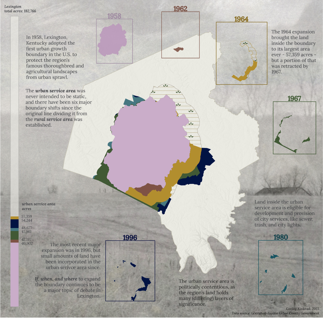
The dated rectangles surrounding the Lexington/Fayette County polygon contain clips visualizing the Urban Service Area's change for that year. The rectangle size is proportionate to the percentage of Lexington/Fayette County that the Urban Serivce Area covers.