I am a geographer, urban planning resesearcher, and fiber artist located in Lexington, Kentucky.
At the University of Kentucky, I am a PhD student and teaching assistant in Geography, student in Digital Mapping/New Maps Plus, and research assistant with Mapshop.
You can see and download my cv here.
maps:
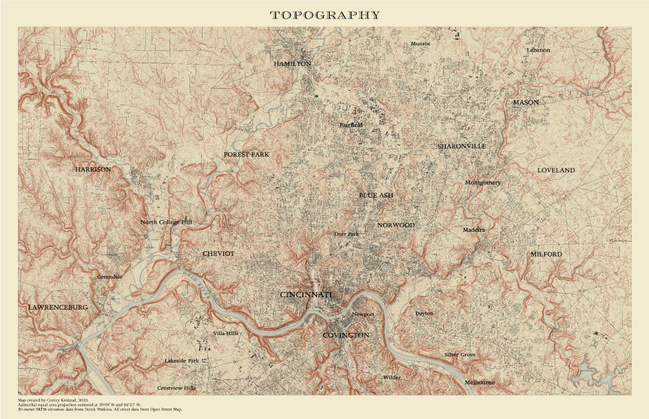
Present-day Cincinnati topographical map inspired by 1912 USGS map of the same area.
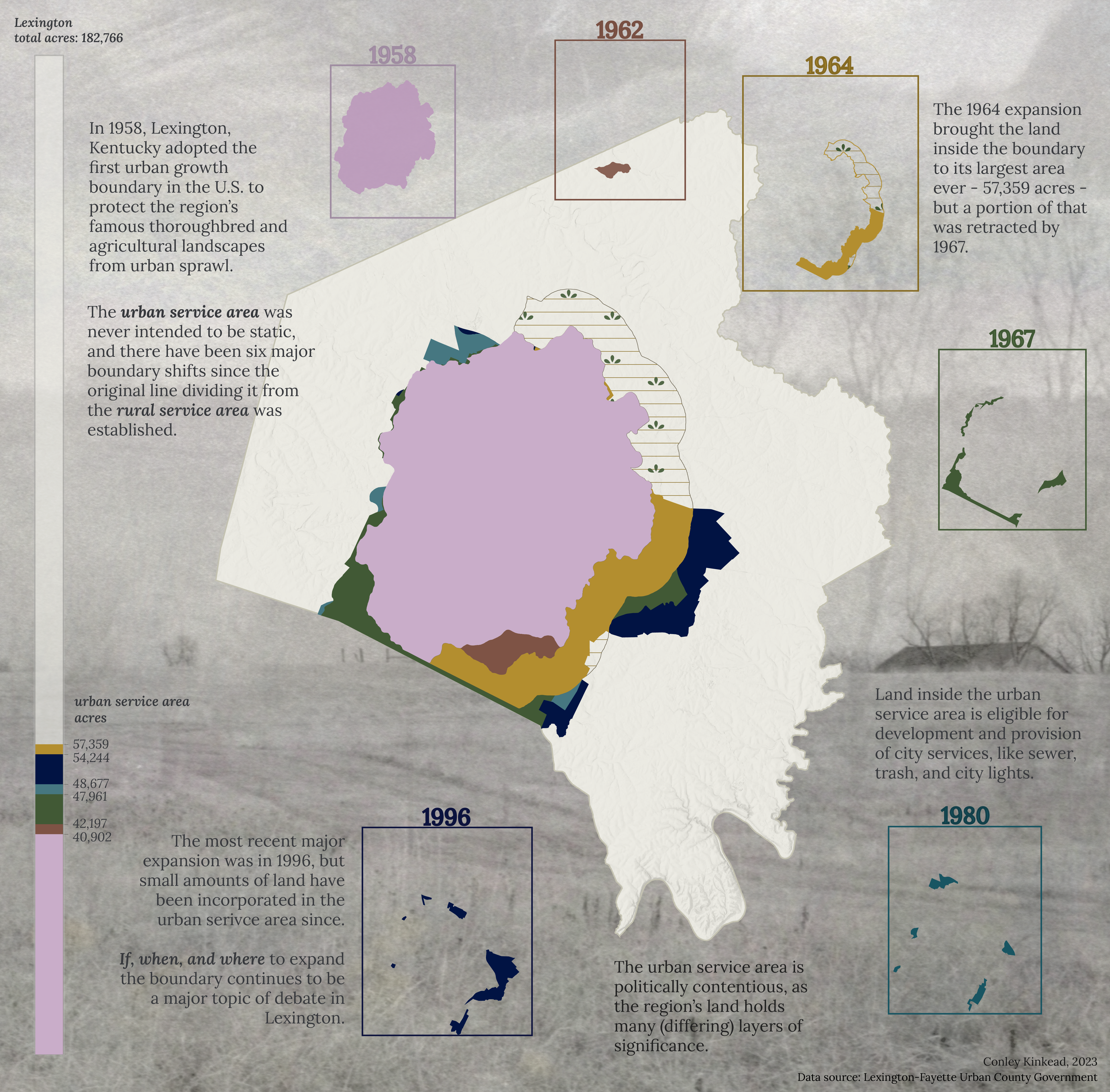
Lexington, Kentucky boasts the earliest-established urban growth boundary in the U.S. This map is part of an ongoing project investigating the role of Lexington's Urban Service Boundary over time.
Interactive web map of Lexington's six major Urban Serivce Boundary iterations. This project won a 2023 Kentucky Association of Mapping Professionals (KAMP) scholarship! See larger map, concept, and process at the project website or check out the GitHub repository.
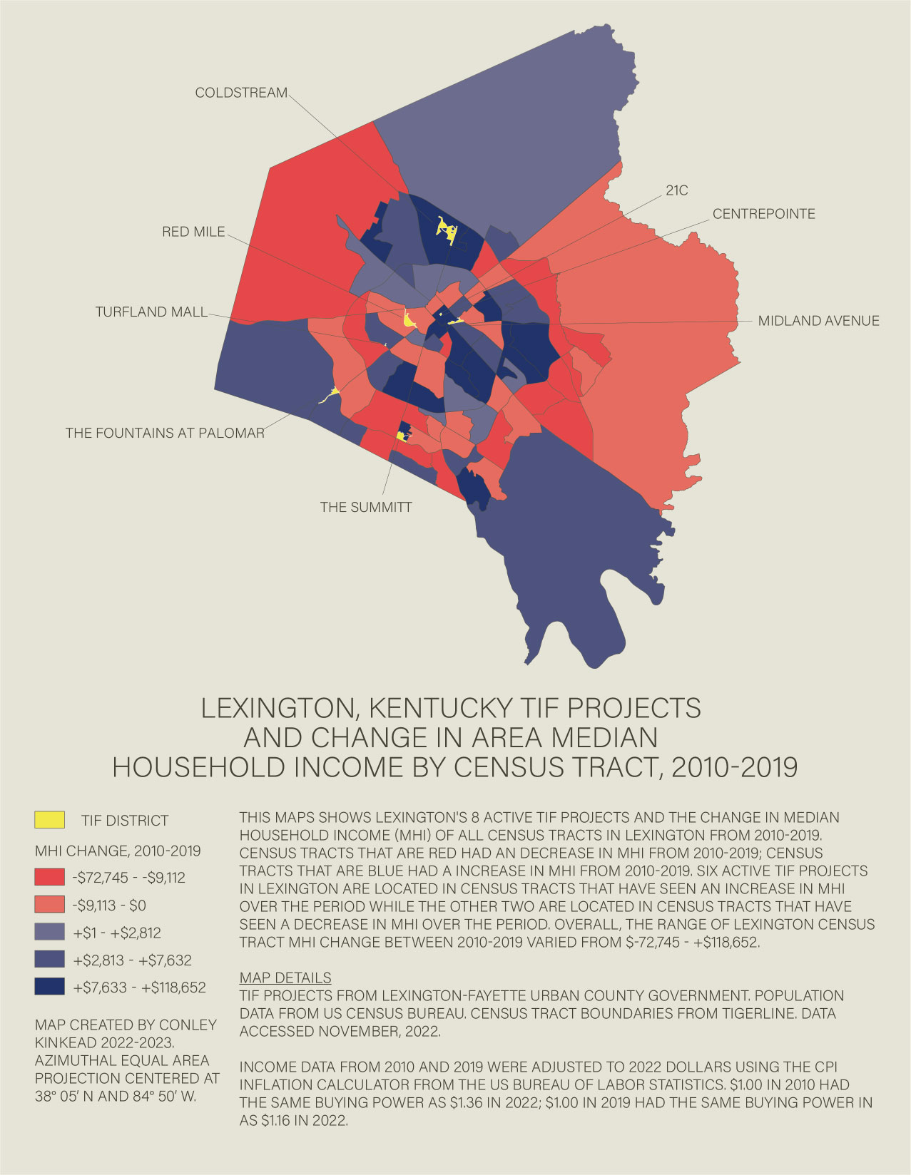
Tax Increment Financing (TIF) is a popular way that local governments subsidize private development in the United States. This choropleth map visualizes the change in median household income (MHI) in Lexington, Kentucky census tracts alongside all area TIF projects. See this project on GitHub. A zoomable web map and more information can be found here.
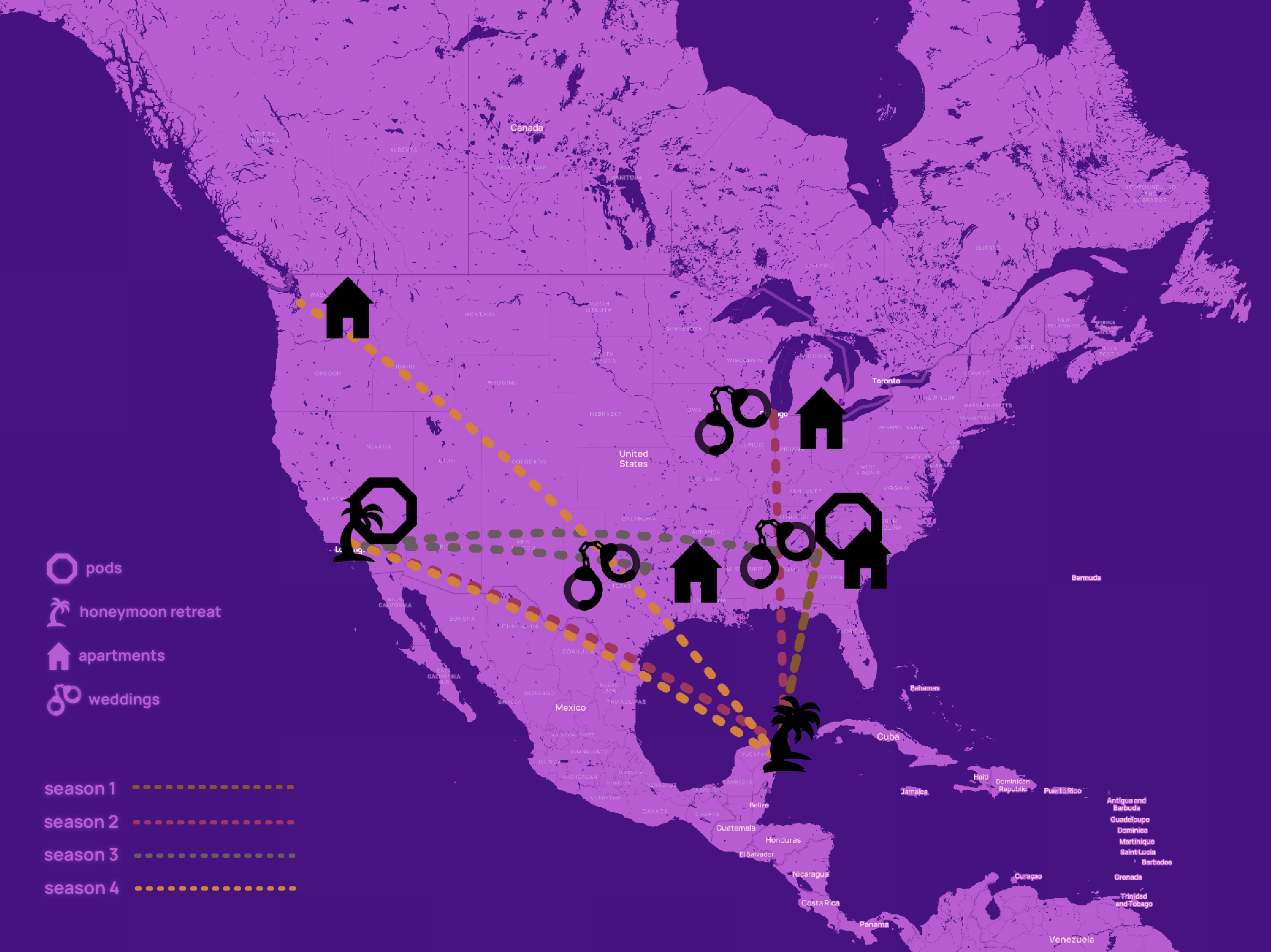
Netflix reality-tv show Love Is Blind (U.S. franchise) seasons 1-4 filming locations. See the project website for more images from this collection or see this project on GitHub.
other projects:
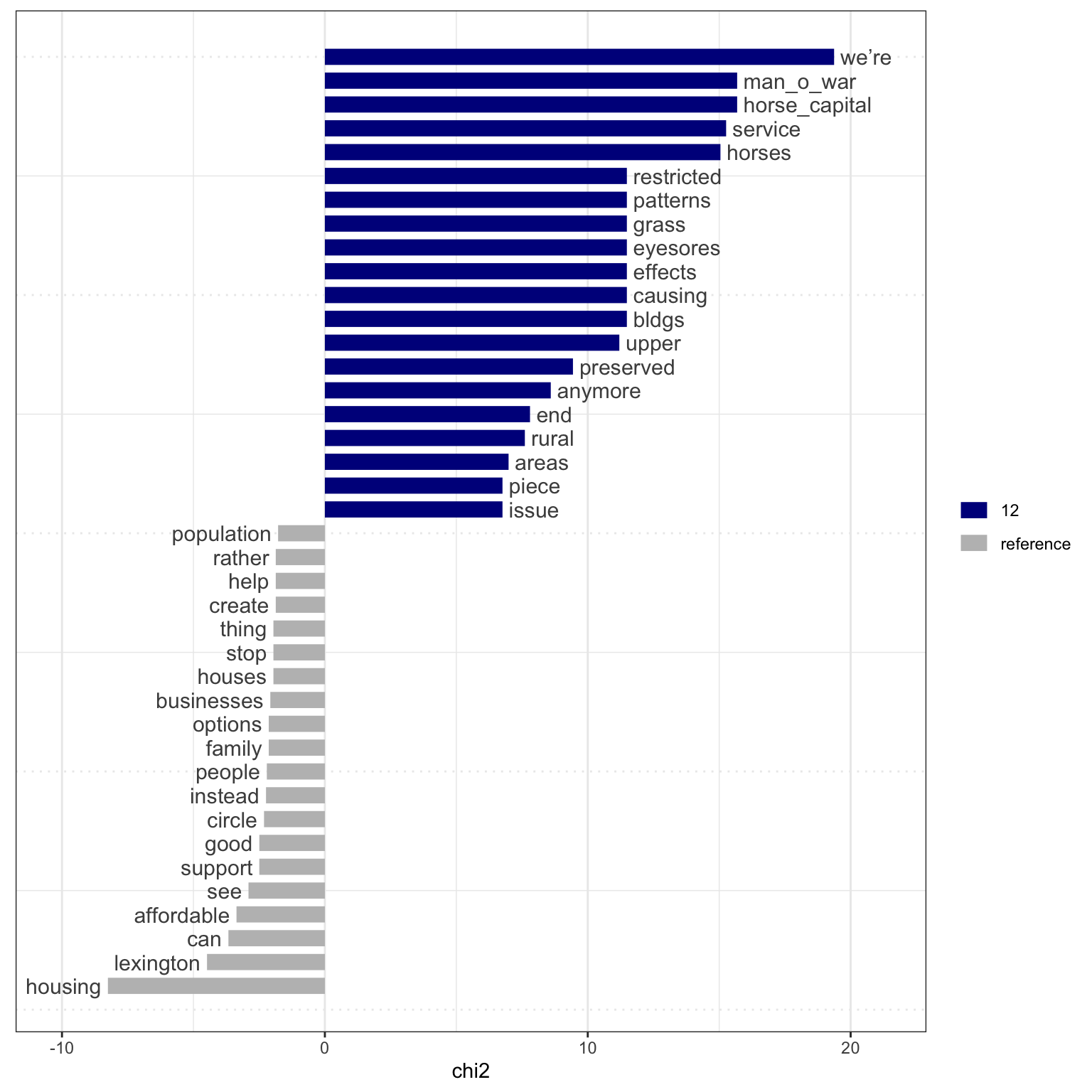
Analysis of urban-rural sentiment in Lexington, Kentucky using R. Project funded by CivicLex. See the project here or the GitHub repository.
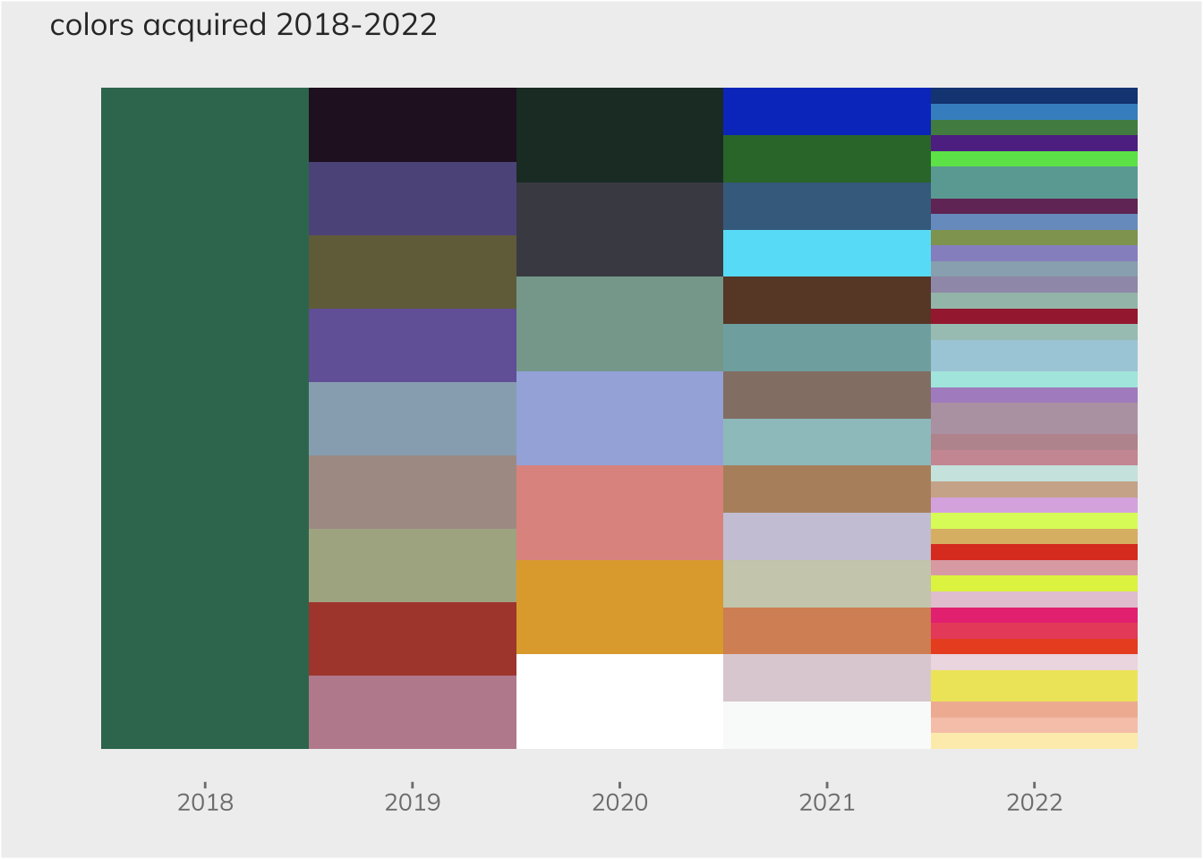
Plots of nail polish project created using ggplot2 in RStudio. See the code and many more plots on the project website or GitHub repository.
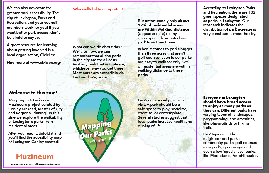
"Mapping Our Parks" zine collaboration with Muzineum.